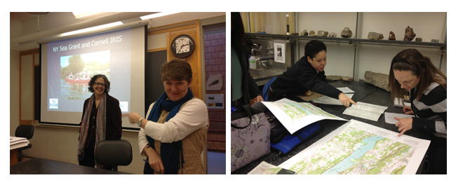
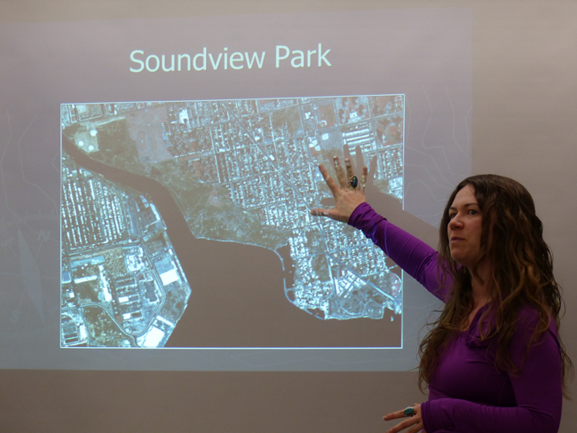
New York Sea Grant's Hudson Estuary Specialist Nordica Holochuck (at far left, above, first photo) and Cornell Institute for Resource Information Sciences Geospatial Program Lead Susan Hoskins (at far right, above, first photo) guided educators (above, second photo) in a series of exercises drawn from a Web-based mapping project on how coastlines change over time along more than 500 miles of New York's urban coastal and estuarine environments. Photos: Paul C. Focazio, NYSG.
New York, NY, June 9, 2014 — "Visualizing coastal change shows us why it's so important to be coastal stewards," says Susan Hoskins, Geospatial Program Lead at the Cornell Institute for Resource Information Sciences (IRIS). For the last several years, Hoskins has been collaborating with New York Sea Grant Hudson Estuary Specialist Nordica Holochuck on a series of related training workshops that has so far involved some 65 elementary school teachers focused on general studies, arts and sciences from throughout New York City's five boroughs and on Long Island.
"We're offering basic map skills to these educators in coordination with New York City education standards," says Holochuck. "The goal here is to make the connection to resources and use these as teaching tools."
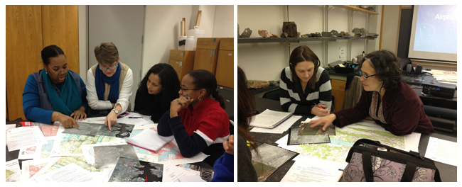
Photos: Paul C. Focazio, NYSG.
During each day-long session, teachers become familiarized with a collection of historic and current topographic and aerial maps for several key locations in and around the New York metro area:
- Staten Island's Arlington Marsh, a haven for harbor herons
- Sound View Park, home to the 24-mile Bronx River, which, as NYC’s only fresh water river, is within the Long Island Sound watershed (see video below)
- Liberty State Park, located less than 2,000 feet from the Statue of Liberty and situated on the New York Harbor and within the Hudson River watershed.
- Saugerties Lighthouse, consisting of 17 acres of wooded grounds and tidal wetland flats along the Hudson River at the mouth of the Esopus Creek.
- Learning materials have also been developed for Big Egg Marsh in the Jamaica Bay region as well as several other sites in the NY metro area.
"Knowing what the coastline was like in the past and comparing it with
what we see now in maps is crucial in these times of sea level rise and
climate change," says Hoskins. And so, Holochuck adds, "These workshop
are geared toward helping teachers understand and use maps, satellite
images and hands-on classroom-based activities so that their students
can better understand how New York City coasts have changed over time
in creative, engaging ways.
"This National Oceanic and Atmospheric Administration (NOAA)-funded
program - which currently spans two-years and four workshops and may
continue into 2015 depending on funding - is a component of Global
Learning and Observation to Benefit the Environment (GLOBE), a K-12th
grade program to improve science education by involving students and
their teachers in world-wide research examining long-term global change. GLOBE's New York chapter
is based at Queens College in Flushing, where the workshops have been
held. GLOBE was founded in 1994 by NOAA, The National Aeronautics and
Space Administration, the Environmental Protection Agency, National
Science Foundation, and the U.S. Departments of Education and State.
A Web site featuring the project's many coastal maps and resources is now online for teachers at www.nyseagrant.org/visualizingcoastalchange.
When later surveyed if they would be able to use the information
provided via the workshops and the Web site, 93% of the teachers asked
said "yes."
— Above article written and related content below compiled by Paul C. Focazio, NYSG's Web Content Manager
Video Synopsis: In the 1600’s, New York City’s Bronx River was a drinking water source and a sylvan haven for beaver, oysters, and herring. It became blighted as urbanization progressed, reincarnating as an industrial power source, an open sewer, and a garbage dump. Today, landscape ecologists are reconstructing the waterway’s ecological history as a reference point for its restoration effort. Watch conservation teams coax new life into the Bronx River as they restock it with native fish, lay down oyster beds, and remove invasive species along its shores. Related Web Site: American Museum of Natural History - Science Bulletins (November 2006)
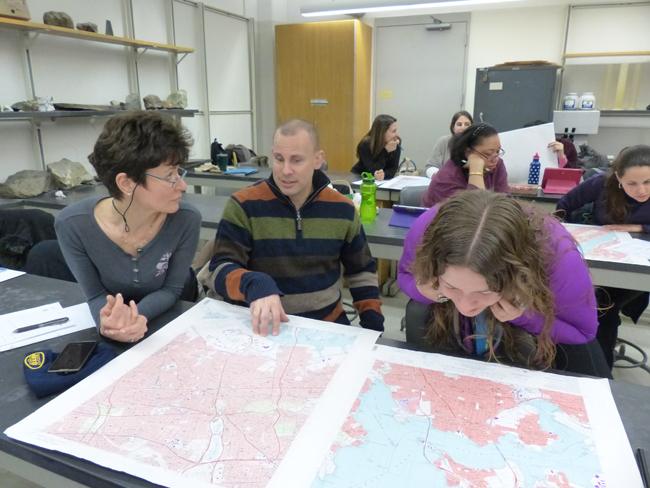
A group of invited elementary school teachers gathered each day during
the first weekend in February 2014 at Queens College to take part in
some "Visualizing Coastal Change" workshops, which are being funded for a
second year through a NOAA Environmental Literacy Grant. These mostly New York
City educators said the mapping exercises were an extremely effective way of learning the material. Photo: David Jakim
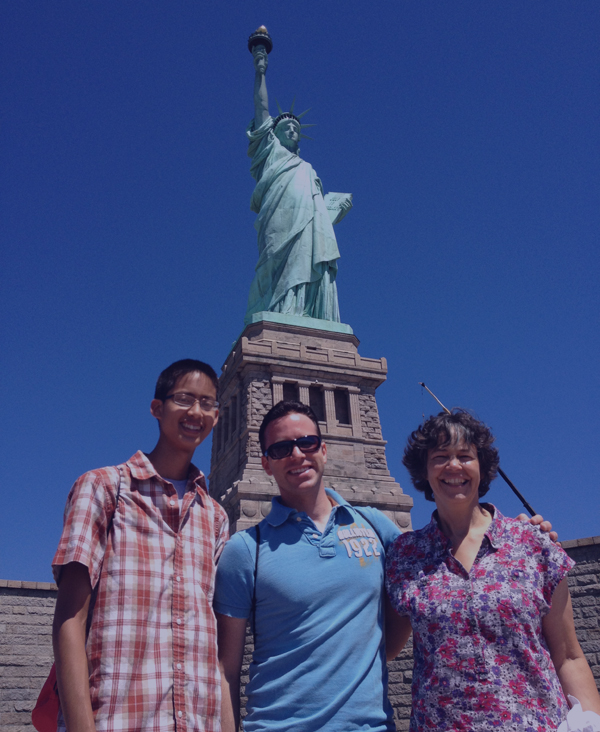
Two of the project's handful of sites were in the spotlight during the February 2014 workshops — Soundview-Bronx River and Liberty State Park, the latter of which NYSG's Nordica Holochuck (at far right, above), along with NYSG's Web Content Manager Paul C. Focazio (in middle, above) and then College of Agriculture and Life Sciences at Cornell University (CALS)-sponsored undergraduate intern Bryan Chan (at far left, above) visited several times since Summer 2012, as detailed in NYSG's related news item, "Coastal Change Education Materials for Metro NY Area." Photo: Paul C. Focazio, NYSG.
And, at the end of each day-long training, the teachers had an opportunity to present to their peers and show the group what they learned.
Photo: David Jakim
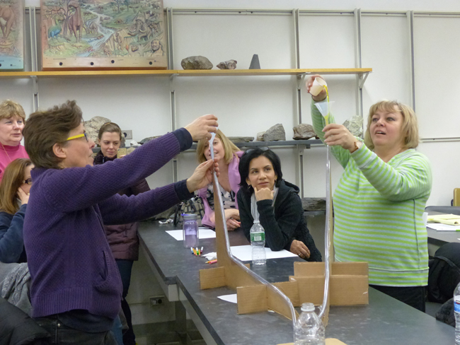
In addition to all the coastal map learning, the educators also tried out several interactive classroom-friendly activities, including the one pictured above: a watershed model mimicking the slope of the Hudson River and its tributaries. The teachers poured different fluids down the tubes—blue-colored water (freshwater) and yellow-colored water (saltwater)—to illustrate how both mix to form the estuarine waters of the Hudson.
Photo: David Jakim
When later surveyed if they would use or adapt to use this or any of the other hands-on activities offered during the workshop, which included both a watershed tracing and puzzle activity, all teachers said "yes." All of the educators also agreed that their knowledge and understanding of watersheds had improved as a result of these workshops.
Some of the individual comments provided back to Holochuck and Hoskins about the workshops included:
- Very informative, interesting and enjoyable activities and a varied classroom format.
- The presenters were extremely knowledgeable and dynamic. They were a wealth of information and I enjoyed their enthusiasm.
- I have a better understanding of the watershed and also how Liberty Park evolved and its impact on the environment.
- I've used the Bronx River restoration video in class before and created topographic maps as part of 5th grade science.
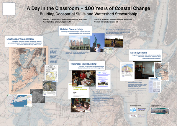
Download full-size version of this poster (pdf) [5 MB file]
On YouTube: NOAA Awards $1.3M Grant To Queens College (September 25, 2012)
In late September 2012, then NOAA Administrator Dr. Jane Lubchenco
presented a certificate of congratulations to Queens College staff and
partners in Queens, N.Y. The institution recently won a $1.3 million
Environmental Literacy Grant award from NOAA to implement a project that
exposes New York City elementary school students to hands-on activities
in outdoor environments and provide professional development to
teachers.
Partnerships with local parks and environmental organizations, including New York Sea Grant, help provide stewardship
and service learning opportunities, enhancing students' environmental
literacy and building an appreciation and understanding of Earth system
science.
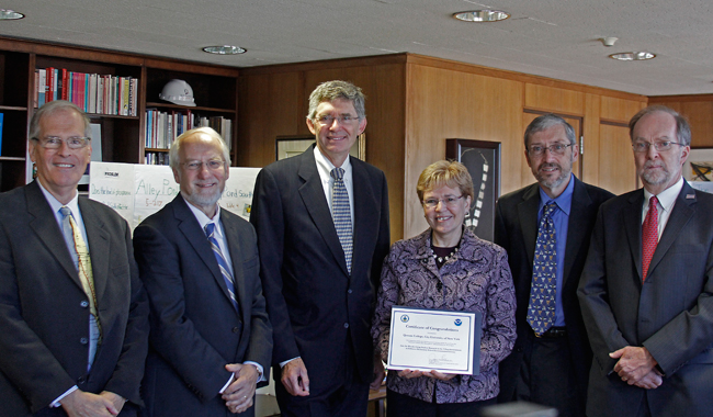
From left to right: Dr. Allan Ludman, Queens College & GLOBE New York Metro director; Dr. James Stellar, Queens College (provost); Dr. James Muyskens, Queens College (president); Dr. Jane Lubchenco, then NOAA Administrator; Peter Schmidt, GLOBE New York Metro & project principal investigator; Dr. James Ammerman, New York Sea Grant (then director). Photo: Queens College
More Info: New York Sea Grant
New York Sea Grant (NYSG), a cooperative program of Cornell University
and the State University of New York, is one of 33 university-based
programs under the National Sea Grant College Program (NSGCP) of the
National Oceanic and Atmospheric Administration (NOAA). The NSGCP
engages this network of the nation’s top universities in conducting
scientific research, education, training and extension projects designed
to foster science-based decisions about the use and conservation of our
aquatic resources. Through its statewide network of integrated
services, NYSG has been promoting coastal vitality, environmental
sustainability, and citizen awareness about the State’s marine and Great
Lakes resources since 1971.
For updates on Sea Grant activities: www.nyseagrant.org has RSS, Facebook, Twitter, and YouTube links. NYSG also offers a free e-list sign up via www.nyseagrant.org/coastlines for NY Coastlines, its flagship publication, which, in 2014, merges with the program's e-newsletter, Currents. NY Coastlines is published several times a year.