
(At left) Land and yard features lost to erosion in Hamlin, NY (Monroe County). (At right) Waves driven onto yard in Rochester, NY (Monroe County). Image credit: 2017 Coastal Flooding Survey Project. Cornell University and New York Sea Grant
Contact:
Mary Austerman, NY Sea Grant, Great Lakes Coastal Community Specialist, P: 315-331-8415, E: mp357@cornell.edu
Newark, NY, October 3, 2017 - This past spring brought historic water levels in history that many communities have seen along the Lake Ontario shore — throughout Jefferson and Niagara Counties.
Flooding has impacted public lands, private land owners, the rental market and marinas and other recreational businesses that bring millions in revenue to the region. This year's high water level event will cost millions (perhaps more) and has already brought a wave of considerable revenue reductions.
Though the area has yet to be declared eligible for federal disaster funds, New York State Governor Andrew Cuomo and local legislators are shining a spotlight with press conferences in places like Edgemere Drive in the Monroe County Town of Greece, which, months later, was still pumping out its low-lying homes.
In late July, New York Sea Grant's (NYSG) Interim Communications Manager Paul C. Focazio visited a number of these sites alongside the program's extension lead, Community Development Specialist Mary Austerman.
At the time, surveys were being conducted in these areas by Cornell University Assistant Professor of Biological and Environmental Engineering Dr. Scott Steinschneider and Cornell University Professor of Natural Resources Dr. Richard C. Stedman. Those hundreds of surveys, which were all logged in by August 31st, are currently being compiled and analyzed by the investigators.
The information collected will be used to identify areas that are most vulnerable to high water levels and inform future community flood risk planning.
For more on this on-going project, visit www.nyseagrant.org/waterlevel2017.
Syracuse, NY, September 26, 2017 - The New York State Senate will hold hearings in the coming months to discuss this record flooding that affected communities along Lake Ontario and the St. Lawrence River.
The first hearing is scheduled for Tuesday, October 10 at 4 p.m. at Mexico High School (3338 Main St., Mexico, Oswego County, NY). A second hearing will be held at a Wayne County site in November.
State Sens. Tom O'Mara and Patty Ritchie will lead the hearing. O'Mara (R-Big Flats) is chairman of the Senate Environmental Conservation Committee. Ritchie (R-Oswegatchie) chairs the Senate Agriculture Committee.
The state senators have invited representatives from the International Joint Commission, the state Department of Environmental Conservation, New York Sea Grant and other agencies to testify at the hearing.
"This is an opportunity for experts to come in and for us to be able to ask questions and hear their responses to what potentially caused this," said Ritchie.
“Our hearts go out to those who live and work on the shorelines of Lake Ontario and the St. Lawrence," said Ritchie. "We have been able to help with the financial cost of the flood damage, but we must also do what we can to ease the toll this damage is taking on everyone’s physical and mental well-being."
“So while I’m proud to have sponsored the Lake Ontario-St. Lawrence Seaway Flood Relief and Recovery Grant Program to help people get back on their feet financially, everyone affected will now get the chance to hear directly from all of the stakeholders and decision-makers.”
O'Mara adds that the hearing is intended to help residents and officials alike understand the factors that caused the flood, and ways officials can prevent future problems.
Watertown, NY, October 10, 2017 - State lawmakers are holding a hearing today (at 4 p.m. at Mexico High School in Oswego County) on flooding this spring and summer along Lake Ontario and the St. Lawrence River.
State Sen. Patty Ritchie along with other state lawmakers are hosting the hearing.
They say it's an opportunity to examine all the factors for this year's flooding.
Ritchie and the other state lawmakers have invited members of the local IJC board, other lawmakers, and representatives from organizations that include the state Department of Environmental Conservation and New York Sea Grant.
In Photos: High Water Impacts for Lake Ontario/St. Lawrence River Property Owners
Photos taken by Paul C. Focazio/ NYSG on July 25 & 27, 2017
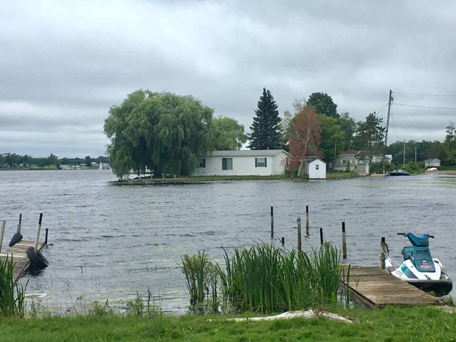
Flooding at Greene Point Marina (around Sandy Pond, Mannsville, NY) began in mid-end of April 2017; Water just began retreating around June 19th; As of late July, levels were still surrounding the building. To compensate for the high water levels, docks at the marina were raised a total of 25" over time. On this 212-acre penninsula you'll find some 138 mobile homes and 33 private land owners.
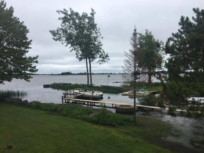
There was high water for many private land owners in and around Sandy Pond. By late July those levels had retreated slightly.
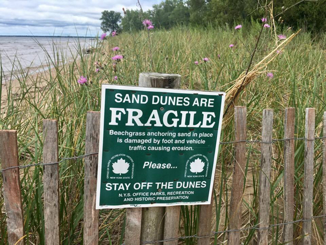
At Southwick Beach State Park, water levels remained high during a late-July visit, at which time very little beach could be seen.
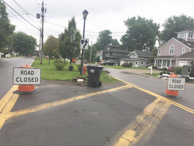
Many a sand bags could still be found by mid-summer in the Village of Sodus Point, where severe flooding led to some road closures for all except residents. Water level highs were seen the first and second weeks in June 2017.
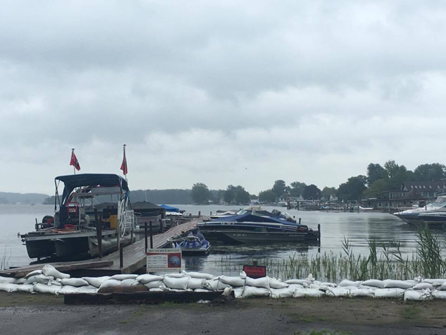
This has been the worst long-term flooding in history for the Village of Sodus Point, as high water levels lasted for numerous months.
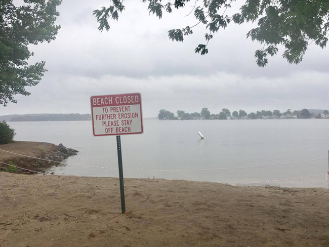
Beach closures in places like the Village of Sodus Point were a common occurence, as high water for extended periods of time meant increased incidents of erosion.
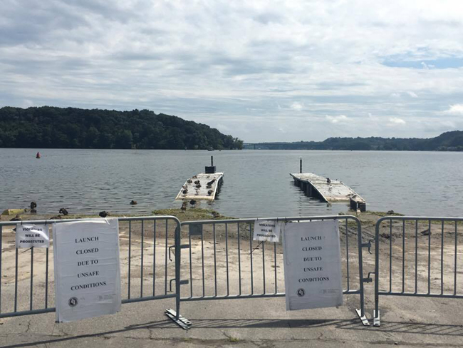
In the Town of Irondequoit, the boat launch was closed and docks were submerged into mid-summer. There were business closures as well as issues of innundation and erosion.
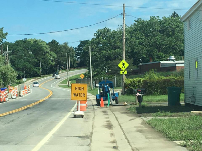
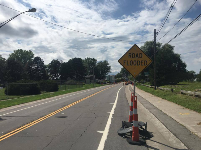
The City of Rochester - which is where New York State Governor Andrew Cuomo held a press conference during the height of flooding in the area - there were road closures by the end of April and beginning of May. Though pumping out from high water persisted through mid-Summer, roads like this one had improved by late July.
On the Salmon Creek, near Lake Ontario in Wayne County, Pultneyville saw flooding, too, but most buildings and residences were spared, as they are slightly higher in elevation up from the water.
More Info: New York Sea Grant
New York Sea Grant (NYSG), a cooperative program of Cornell University
and the State University of New York, is one of 33 university-based
programs under the National Sea Grant College Program (NSGCP) of the
National Oceanic and Atmospheric Administration (NOAA). The NSGCP
engages this network of the nation’s top universities in conducting
scientific research, education, training and extension projects designed
to foster science-based decisions about the use and conservation of our
aquatic resources. Through its statewide network of integrated
services, NYSG has been promoting coastal vitality, environmental
sustainability, and citizen awareness about the State’s marine and Great
Lakes resources since 1971.
New York Sea Grant maintains Great Lakes offices at SUNY Buffalo, the
Wayne County Cooperative Extension office in Newark and at SUNY Oswego.
In the State's marine waters, NYSG has offices at Stony Brook University
and Stony Brook Manhattan, in the Hudson Valley through Cooperative
Extension in Kingston and at Brooklyn College.
For updates on Sea Grant activities: www.nyseagrant.org has RSS, Facebook, Twitter, and YouTube links. NYSG produces a monthly e-newsletter, "NOAA Sea Grant's Social Media Review," via its blog, www.nyseagrant.org/blog. Our program also offers a free e-list sign up via www.nyseagrant.org/coastlines for its flagship publication, NY Coastlines/Currents, which is published 1-2 times a year.