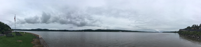
Hudson River from FDR Home & Presidential Library in Hyde Park NY. Credit: Susan Hoskins/Cornell IRIS
Contacts
Nordica Holochuck, New York Sea Grant, Hudson Estuary Specialist, P: 845.340.3983, E: nch8@cornell.edu
Susan B Hoskins, Cornell University Institute for Resource Information Sciences E: sbh1@cornell.edu
Kingston, NY, September 5, 2017 - This past July, New York Sea Grant partnered with Cornell University’s Institute for Resource Information Sciences to bring a National Geographic Alliance-sponsored New York State Giant Traveling Map to the 2017 Teaching the Hudson Valley (THV) Summer Institute, "Building Community with Place-Based Learning," at the Henry A. Wallace Visitor & Education Center, FDR Home & Presidential Library in Hyde Park NY.
THV helps educators discover, appreciate, and share the region’s natural, historic, and cultural treasures with children and youth, fostering collaboration among organizations.
“I can’t wait to use these maps in my classroom,” said a ES teacher, Horizons-on -the Hudson, Newburgh ECSD. An educator from Lamont_Doherty Earth Observatory added: “I fully enjoyed the presentation and the ideas.” Credit: Debi Duke/THV
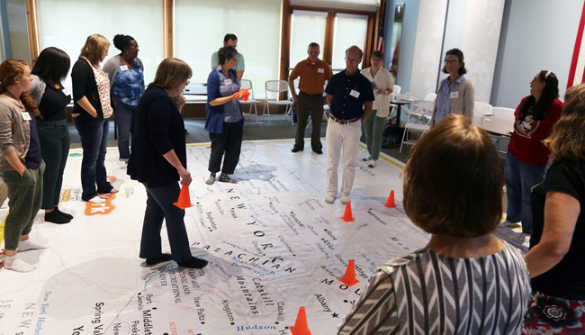
Nordica Holochuck, New York Sea Grant's Hudson Estuary Specialist said, “Building community with place- based learning naturally requires understanding where we live, work and play along varying scales (local to global). Our workshop at this year’s institute aimed to introduce educators to a newly developed resource, a classroom sized 16x20 foot giant New York State floor map available on loan, free of charge for use at their schools."
Approximately 20 educators participated in the well-received two hour workshop, several reporting that they would indeed seek to host the map at their schools.
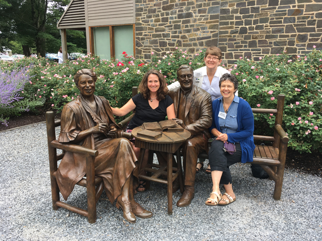
Posing with FDR and wife Eleanor Roosevelt are (l-r) New York Sea Grant Associate Director Katherine Bunting-Howarth (at far left), Cornell University's Susan Hoskins and NYSG's Nordica Holochuck. The later two co-presented their "Hands (and Feet) on Learning" activities at THV's mid-summer workshop. Says Holochuck of the hands-on map exercises, which were designed to meet NYS learning standards, "We emphasized the water features on the map and tied in geospatial concepts by focusing in on the local coastal communities displayed right at our feet." Credit: Susan Hoskins/Cornell IRIS
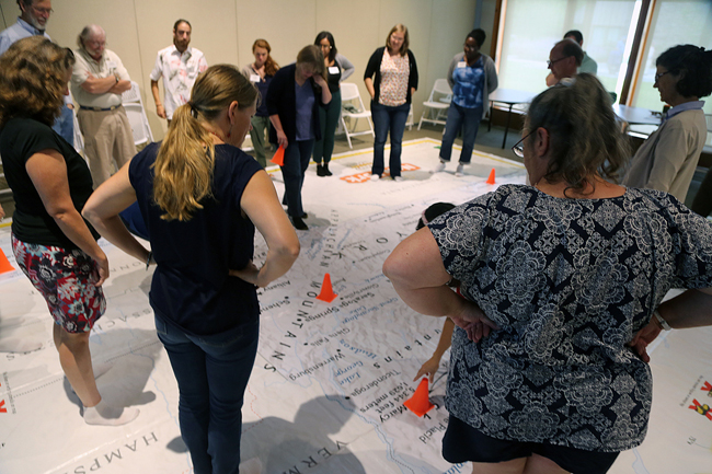
Co-presenter Susan Hoskins, Cornell University Senior Extension Specialist (whose program hosts the map) said, “Educators from the Hudson Valley jumped in the both feet, literally, to explore map reading, spatial thinking and place-based learning on the New York Giant Traveling Map. Measuring the length of the Hudson River on the floor map with heel-to-toe footsteps gave a new spatial understanding of the geography of place and community."
"Judging by the enthusiastic engagement of educators to the activities," Hoskins continued, "it’s clear that partnering with Nordica Holochuck from New York Sea Grant and using National Geographic resources, we put Hudson Valley learning on the map! New York borders both the Great Lakes and Atlantic and this floor map gives participants a unique opportunity to 'explore' the coasts.”
“I can't wait to bring the map to my school,” said a special educator with Onteora Schools. A grade 5 teacher from Spackenkill, NY added: “I enjoyed the activity and what it had to offer. I hope to contact National Geographic for use of the continent maps. This was interesting and valuable.” Credit: Debi Duke/THV
Workshop attendees were provided with geospatial learning resource fact sheets and information about the NYS geospatial alliance map loan program. The National Geographic-generated activities that come with the map are geared for younger (elementary) grades.
Holochuck looks forward to working with Hoskins this fall to develop a NYS coastal/water resources specific brief to be included with the map lesson plans as it travels to classrooms throughout New York State.
For resources from the workshop, including those from "Hands (& Feet) on Learning: NY Giant Traveling Map," visit Teaching the Hudson Valley's Web site.
More Info: New York Sea Grant
New York Sea Grant (NYSG), a cooperative program of Cornell University
and the State University of New York, is one of 33 university-based
programs under the National Sea Grant College Program (NSGCP) of the
National Oceanic and Atmospheric Administration (NOAA). The NSGCP
engages this network of the nation’s top universities in conducting
scientific research, education, training and extension projects designed
to foster science-based decisions about the use and conservation of our
aquatic resources. Through its statewide network of integrated
services, NYSG has been promoting coastal vitality, environmental
sustainability, and citizen awareness about the State’s marine and Great
Lakes resources since 1971.
New York Sea Grant maintains Great Lakes offices at SUNY Buffalo, the
Wayne County Cooperative Extension office in Newark and at SUNY Oswego.
In the State's marine waters, NYSG has offices at Stony Brook University
and Stony Brook Manhattan, in the Hudson Valley through Cooperative
Extension in Kingston and at Brooklyn College.
For updates on Sea Grant activities: www.nyseagrant.org has RSS, Facebook, Twitter, and YouTube links. NYSG produces a monthly e-newsletter, "NOAA Sea Grant's Social Media Review," via its blog, www.nyseagrant.org/blog. Our program also offers a free e-list sign up via www.nyseagrant.org/coastlines for its flagship publication, NY Coastlines/Currents, which is published 1-2 times a year.