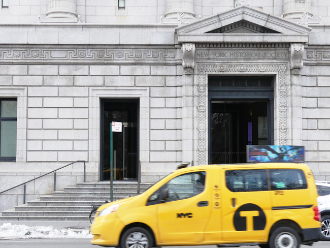
An exhibit at the New York Historical Society in NYC features content from a multi-year New York Sea Grant extension and education project that examines changes to New York metro coastlines over time. Hudson Rising is on display at NYHS through early August 2019. Credit: Ryan Strother/NYSG.
NY Sea Grant’s Mapping Efforts Provide Educational Resources across the Hudson Valley and Metro New York
New York, NY, April 18, 2019 - How do you get into the New York Historical Society (NYHS)? For Brian Chan, an opportunity to contribute to the NYHS’s Hudson Rising exhibit (currently on view through August 9, 2019) would come seven years after completing an internship sponsored by the Cornell College of Agriculture and Life Sciences at Cornell University (CALS) and supported by New York Sea Grant (NYSG) and Cornell Institute for Resource Information Sciences (IRIS).
During summer 2012, Chan spent time digitizing Sea Grant and Cornell IRIS materials used in a series of NY Metro area coastal change mapping professional development workshops for teachers and educators. Additionally, he was encouraged by his internship mentor, NYSG’s Hudson Estuary Specialist Nordica Holochuck, to get involved in field experiences to better understand the River. One willing partner was the Hudson River Reserve. Dan Miller, the Reserve Restoration Coordinator, invited Chan out on his research vessel for an afternoon. In exchange, the intern used his Photoshop skills to help Miller present a visualization of coastal changes occurring over time along the Hudson.
Two of the "Visualizing Coastal Change" project's handful of sites were in the spotlight during a handful of 2014 and 2015 teacher training workshops — Soundview-Bronx River and Liberty State Park, the latter of which NYSG's Nordica Holochuck (at far right, above), along with NYSG's then Web Content Manager (and current Communications Manager) Paul C. Focazio (in middle, above) and then College of Agriculture and Life Sciences at Cornell University (CALS)-sponsored undergraduate intern Bryan Chan (at far left, above) visited several times beginning in Summer 2012 to gather information for the project's educational component.
The internship, and resulting outreach efforts, were a product of Holochuck’s career-long NYSG work with Cornell IRIS partner, Sr. Extension Specialist Susan Hoskins, to make historical maps of NY coastlines, geospatial skills, and educational programming available to educators in the Hudson Estuary and the New York Metro region.
While much has changed in technology since the project began, historical maps remain relevant for understanding hydrological change. They are also the heart of Holochuck and Hoskin’s “Visualizing Coastal Change” project, www.nyseagrant.org/visualizingcoastalchange, which spans some 500 miles of New York coastal and estuarine environments, including the Hudson Valley, and has helped build cartography skills among more than 200 K-12 educators in the Mid-Hudson and New York metro areas.
Hudson Rising explores 200 years of ecological change and environmental activism along “the most interesting river in America” through artifacts, media, and celebrated Hudson River School paintings. Credit: Ryan Strother/NYSG.
The impact of these mapping efforts have been enjoyed by the visitors of New York’s many significant environments and landmarks. One of those landmarks, Liberty Island, was a focus of the web-based mapping project. Chan worked with Holochuck and Paul C. Focazio, NYSG’s communications manager, to develop an educational curricula for Liberty Island and a number of other key NYC sites. Following the July 4, 2013 re-opening of Liberty Island after closure due to late October 2012’s Superstorm Sandy, the interpretive curricula was made available online to support related educational programming.
More recently, Holochuck and Hoskins have teamed up on other mapping outreach efforts, including a giant traveling map, a product of National Geographic and the NYS Geospatial Alliance that is sized to provide “feet-on” cartography experiences for elementary schools, graduate students, and educators alike. The pair created additional map activities to engage and educate students about New York’s multitude of aquatic resources. These efforts were then tested during NYSG-led giant map workshops, including one in July 2017 attended by approximately 30 educators.
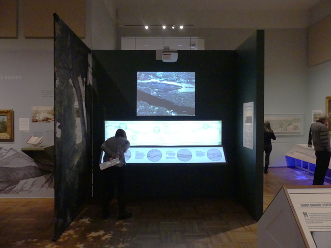
Hudson Rising reflects on how human activity has impacted the river and, in turn, how the river environment has shaped industrial development, commerce, tourism, and environmental awareness. The exhibition also explores how experts in various fields are currently creating ways to restore and re-engineer areas of the river in response to climate change. Credit: Ryan Strother/NYSG.
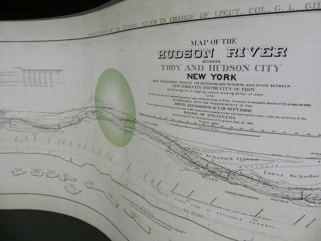
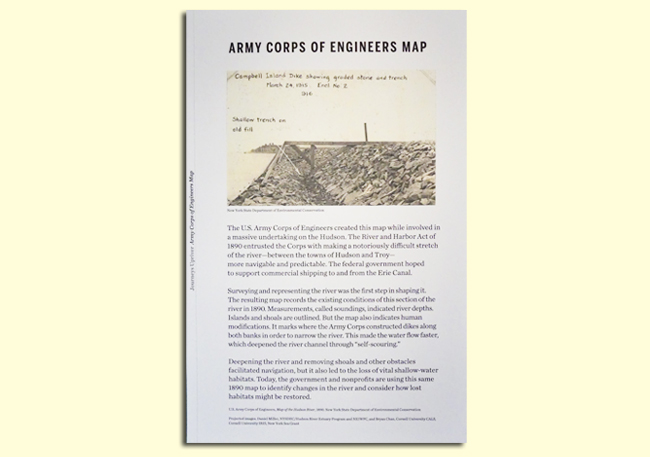
Most recently, some of the historical maps created during Chan’s internship are on display in NYHS Hudson Rising exhibit, which explores over 200 years of ecological change and environmentalism in the Hudson Valley, New York Harbor area, and the Adirondacks. Some slides, borne out of Chan’s 2012 work with Miller illustrate the change over time in the Stockport Creek area of the Hudson River. Historic maps and current photos are featured in a display focused on changes caused by deepening the river, removing shoals, and other actions taken by the U.S. Army Corps of Engineer as a boon to navigation, but sometimes at the expense of fragile ecological areas.
As for Chan, while he graduated from Cornell in 2016, the mapping work he did as an intern in 2012 remains very useful for illustrating the changing Hudson River. And while Holochuck retired from NYSG in mid-March 2019, her mapping resources and curricula will continue to inspire students in New York’s classrooms long after her tenure as the program’s Hudson Estuary Specialist.
Much more than a body of water, the Hudson and its surroundings have been the home for humans and hundreds of species of fish, birds, and plants; offered an escape for city-dwellers; and witnessed battles over the uses of the river valley and its resources. For over 200 years, writers and artists have captured the river in paintings, drawings, literature, and photographs, and surveyors and scientists have mapped and measured its every parcel. Credit: Ryan Strother/NYSG.
More Info: New York Sea Grant
New York Sea Grant (NYSG), a cooperative program of Cornell University
and the State University of New York (SUNY), is one of 33 university-based
programs under the National Oceanic and Atmospheric Administration’s
National Sea Grant College Program.
Since 1971, NYSG has represented a statewide network of integrated
research, education and extension services promoting coastal community
economic vitality, environmental sustainability and citizen awareness
and understanding about the State’s marine and Great Lakes resources.
Through NYSG’s efforts, the combined talents of university scientists
and extension specialists help develop and transfer science-based
information to many coastal user groups—businesses and industries,
federal, state and local government decision-makers and agency managers,
educators, the media and the interested public.
The program maintains Great Lakes offices at Cornell University, SUNY
Buffalo, SUNY Oswego and the Wayne County Cooperative Extension office
in Newark. In the State's marine waters, NYSG has offices at Stony Brook
University in Long Island, Brooklyn College and Cornell Cooperative
Extension in NYC and Kingston in the Hudson Valley.
For updates on Sea Grant activities: www.nyseagrant.org has RSS, Facebook, Twitter, and YouTube links. NYSG offers a free e-list sign up via www.nyseagrant.org/nycoastlines for its flagship publication, NY Coastlines/Currents, which is published quarterly. Our program also produces an occasional e-newsletter,"NOAA Sea Grant's Social Media Review," via its blog, www.nyseagrant.org/blog.