Stony Brook, NY, August 12, 2013 - Late last summer, a number of partners - including the New York State Department of Environmental Conservation (NYSDEC), Connecticut Department of Energy & Environmental Protection (CTDEEP), the U.S. Environmental Protection Agency (EPA) and the National Oceanic and Atmospheric Administration (NOAA, Sea Grant's federal funding agency) - announced a multi-year seafloor mapping project for Long Island Sound.
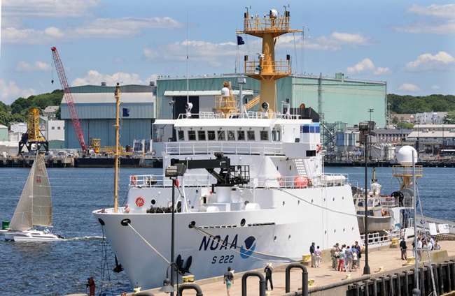
Following a June 2012 kick-off in Connecticut's New London Harbor - during which the CTDEEP held a press event on board the Thomas Jefferson for public officials and area scientists to learn about the ship's capabilities - a second announcement of the partnership was held aboard Stony Brook University (SBU) School of Marine and Atmospheric Sciences (SoMAS) Research Vessel “Seawolf,” which is stationed in Port Jefferson Village, Long Island, NY.
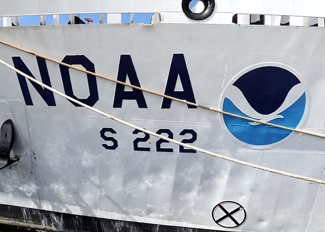
In addition to SBU's R/V Seawolf, the NOAA Ship Thomas Jefferson and research vessels from the University of Connecticut (UConn) began embarking last summer on this pilot project to map the seafloor of Long Island Sound. The initial survey took place in the mid-Sound area of Stratford Shoal, extending from New York on the North Shore of Long Island to the Connecticut shoreline.
Over the next several years, marine scientists are continuing the project, surveying various areas of the Sound using sonar mapping and other sophisticated equipment on board these ships. These technologies will help to characterize the location, extent and character of bottom habitats and the spatial relationships of the biological communities that inhabit them. The objective is to map all the major habitats of the Sound's seafloor to help guide future decisions about its uses.
Funding for this project comes from a June 2004 settlement between Connecticut, New York, Long Island Power Authority, Northeast Utilities, and the Cross Sound Cable Company. In addition to the EPA, NOAA, CTDEEP, NYSDEC, SBU and UConn, partners in the research effort include the states of Connecticut and New York, the University of New Haven, Columbia University, and the University of Rhode Island. The Long Island Sound Study (LISS) Policy Committee has played an important role in helping to establish guidelines on how the settlement funds would be used.
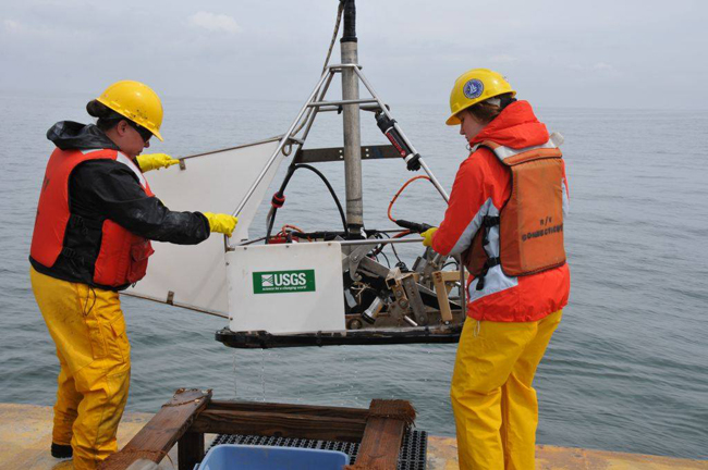
Photo: Dann Blackwood, U.S.G.S.
To read a related fact sheet and check out additional information about this project, check out LISS's seafloor mapping Web page or LISS's Fall 2013 issue of Sound Update (pdf)
UConn's media office also posted a blog entry (pdf) profiling Ivar Babb, director of UConn’s Northeast Underwater Research Technology and Education Center, and the lead investigator of the pilot project.
In Summer 2012, NOAA also published an article (pdf) about the data being collected by the Thomas Jefferson.
More Info: Long Island Sound Study
Long Island Sound is one of the 28 nationally-designated estuaries under
the NEP, which was established by Congress in 1987 to improve the
quality of Long Island Sound and other places where rivers meet the sea.
The Long Island Sound Study, conducted under the Environmental
Protection Agency’s (EPA) National Estuary Program (NEP), is a
cooperative effort between the EPA and the states of Connecticut and New
York to restore and protect the Sound and its ecosystems.
For more on what you can do to make a difference, click over to the "Get Involved" or "Stewardship" sections of the Long Island Sound Study's Web site. News on the Long Island Sound Study can also be found in New York Sea Grant's related archives.
If you would like to receive Long Island Sound Study's newsletter, please visit their site's homepage and sign up for the "e-news/print newsletter" under the "Stay Connected" box.
For daily updates and tips on how you can help protect and restore Long Island Sound, please join LISS on Facebook or, sign up for their RSS feeds.
— Compiled by Paul C. Focazio
On YouTube: Video of June 2012 Connecticut press event via a reporter from the New Haven Register
Photos from New Haven Register
(Mara Lavitt/New Haven
Register 6/15/12)
New London Harbor. The NOAA and several universities will join together
to map the floor of Long Island Sound. The NOAA ship the Thomas
Jefferson will be doing much of the scanning work.
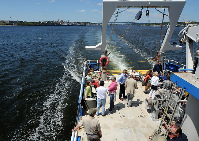
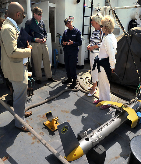
Aboard the Research Vessel Connecticut which will be used in the mapping.
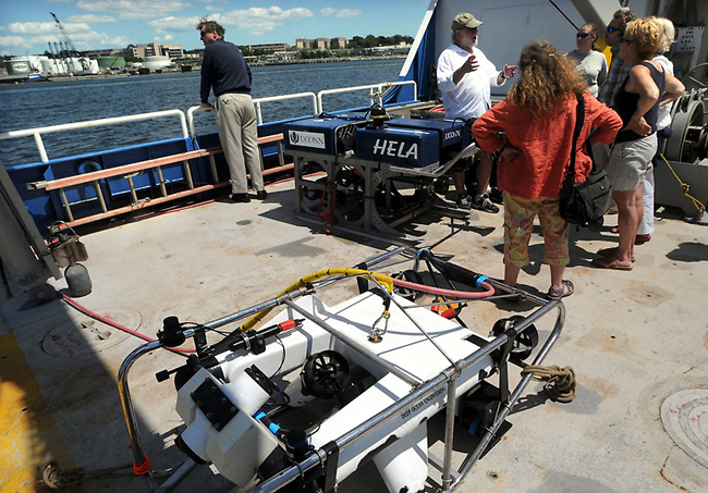
Aboard the Research Vessel Connecticut with the two remotely-operated research vehicles.
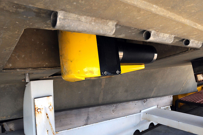
The NOAA ship the Thomas Jefferson will be doing much of the scanning
work, primarily using this multi-beam echo sounder (in yellow and black)
on the underside of a launch.
Aboard the Research Vessel Connecticut one of the side-scan sonar
devices (at lower right) is explained by Lt. Cmdr. Denise Gruccio to DEEP
Dep. Comm. Mackey McClearly (left), Sen. Ed Meyer, and State Reps. Pat
Widlitz and Lonnie Reed (right).
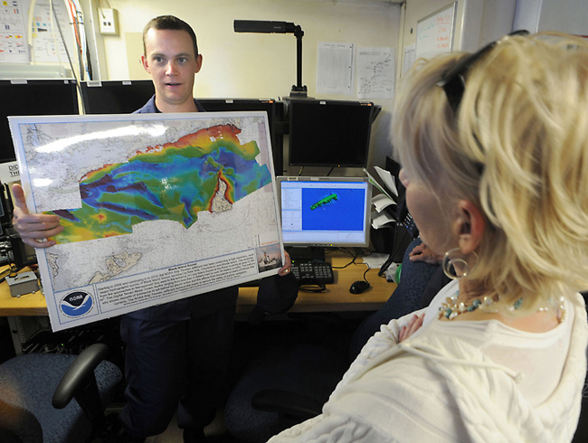
The NOAA ship the Thomas Jefferson will be doing much of the scanning
work. Ensign Andrew Clos (left) with a high-resolution, multi-beam
hydrographic map survery of Block Island Sound. The maps of Long Island
Sound will resemble that one. State Rep. Lonnie Reed of Branford is at
right.
Aboard the Research Vessel Connecticut State Sen. Ed Meyer (left), and
State Rep. Lonnie Reed (second from left) with UConn marine ecology
professor Peter Auster (right).
Aboard the Research Vessel Connecticut State Rep. Lonnie Reed (left) with
UConn marine ecology professor Peter Auster and CT DEEP director of
policy Jessie Stratton (right).
Aboard the Research Vessel Connecticut CT DEEP Mackey McCleary Deputy
Commissioner (left) and UConn physical oceanography professor James
O'Donnell (right) with seafloor scanning.
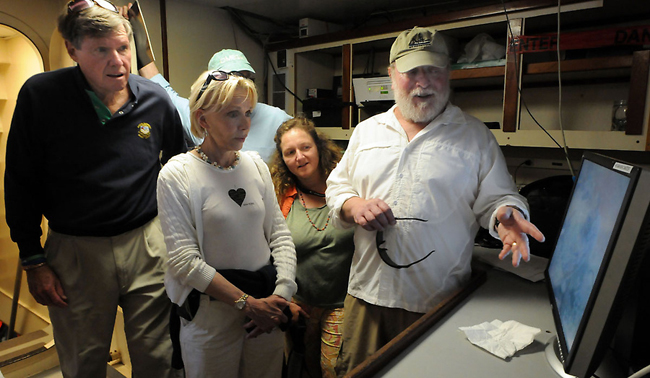
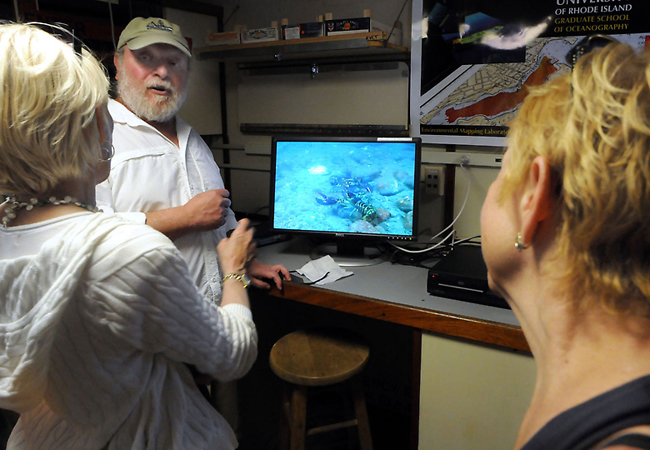
Survery technicians in the plot room.
Senior survey technician Douglas Wood discusses sea floor scans.
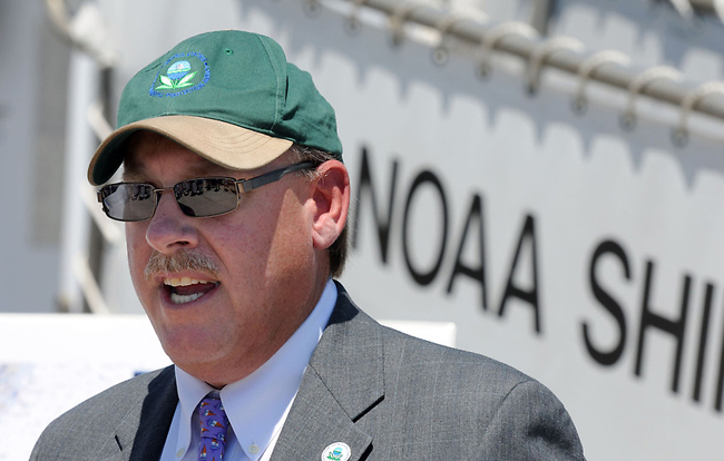
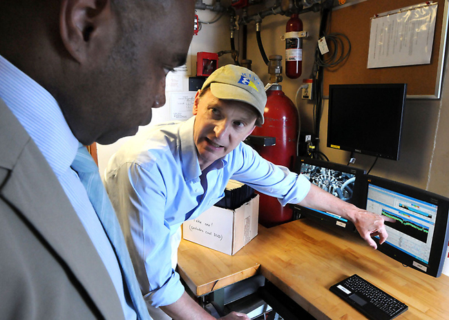
Curt Spalding, the Region One EPA administrator.
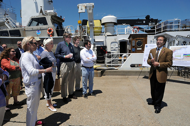
Mark Tedesco, director of the US EPA Long Island Sound office introduces
legislators and others to the mapping project.
New London Harbor. The NOAA and several universities will join together
to map the floor of Long Island Sound. The NOAA ship the Thomas
Jefferson will be doing much of the scanning work.
More Info: New York Sea Grant
New York Sea Grant (NYSG), a cooperative program of Cornell University
and the State University of New York, is one of 33 university-based
programs under the National Sea Grant College Program (NSGCP) of the
National Oceanic and Atmospheric Administration (NOAA). The NSGCP
engages this network of the nation’s top universities in conducting
scientific research, education, training and extension projects designed
to foster science-based decisions about the use and conservation of our
aquatic resources. Through its statewide network of integrated
services, NYSG has been promoting coastal vitality, environmental
sustainability, and citizen awareness about the State’s marine and Great
Lakes resources since 1971.
For updates on Sea Grant activities: www.nyseagrant.org has RSS, Facebook, Twitter, and YouTube links. NYSG also offers a free e-list sign up via www.nyseagrant.org/coastlines for NY Coastlines, its flagship publication, and Currents, its e-newsletter supplement, each distributed several times a year.