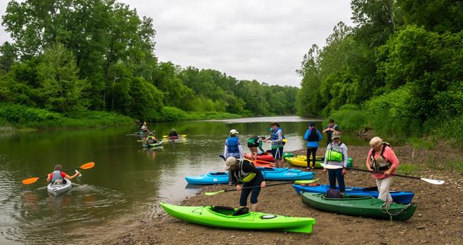
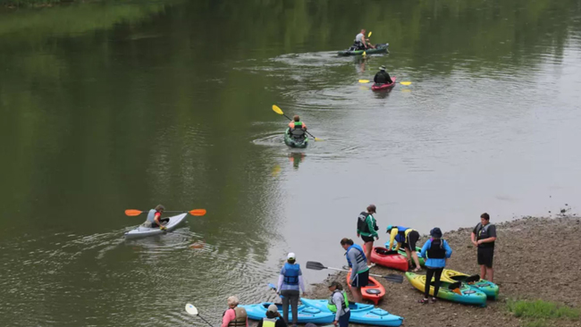
A early June 2019 paddle event on the Genesee River. Credit: Genesse River Watch
— Versions of this story were published by the Steuben Courier, Wellsville Daily Reporter, The Batavian, among others
NOTE: This effort is related to a 2017-18 Great Lakes small grant funded through New York Sea Grant and the NYS Department of Environmental Conservation. The project was led by the Genesee RiverWatch. More on that and other projects in the series at "NYSDEC and NY Sea Grant Announce $199,575 in Grants for Great Lakes Basin Projects."
Rochester, NY, August 25, 2020 — A new Genesee River Blueway Map is ready for use by canoeists and kayakers who wish to explore and connect with the river.
The downloadable Overview Map (pdf) shows current river access locations from Pennsylvania to Lake Ontario.
A web-based Interactive Map gives users detailed information about each access point, including photos of the sites. Printed copies of the Overview Map will be available at access points over the next few months as signage and map holders are installed. The advantage of the online map is that it can be updated as necessary to provide current information about access points.
Overview Blueway Map
Interactive Blueway Map
Genesee RiverWatch partnered with Genesee River Wilds in Allegany County and the Genesee Valley Conservancy in Geneseo to develop the Blueway Map.
The new map updates a 2004 version produced by the Sierra Club Rochester Regional Group.
Today’s map adds new sites and removes those which have fallen into disrepair and are unsafe to use. The addition of an expanded online map will allow information to be updated frequently and to include data on river conditions and nearby services that would not fit on a printed document.
The work was funded by a $25,000 grant from New York Sea Grant and financial and in-kind support from the Greater Allegany County Chamber of Commerce.
As part of this project, Genesee RiverWatch developed a prioritized list of sites for new and improved access based on input from stakeholders and citizens, aerial imaging, GIS, the work of others, and site visits.
This work is summarized in the Genesee River Canoe/Kayak Access Improvement Plan 2019.
A new Genesee River Blueway Map is now available for use by canoeists and kayakers who wish to explore and connect with the river. Credit: Steuben Courier.
More Info: Genesee River
Genesee River Facts
The Genesee River flows 157 miles from its sources near Gold, Pennsylvania to Lake Ontario at Rochester, New York. The Genesee Basin drains approximately 2,500 square miles in Monroe, Livingston, Genesee, Orleans, Wyoming, Ontario, Steuben, Allegany and Cattaraugus counties in New York and Potter County in Pennsylvania. Twenty-four sub-watersheds of the Genesee contain 5,048 miles of streams.
Current land use within the watershed is approximately 52-percent agricultural, 40-percent forest, 4-percent urban, 2-percent wetlands, and 2-percent other developed lands.
The Genesee River has been shaped by its glacial history. The last glacier receded around 12,000 years ago, leaving the spectacular Letchworth gorge and magnificent waterfalls, but also unconsolidated soils that erode easily and produce approximately 420,000 tons of river sediment each year.
Genesee RiverWatch
Genesee RiverWatch Inc. improves the water quality of the Genesee River and its tributaries to create environmental, recreational, and economic assets for its communities. We also connect people to the river, encouraging them to explore, experience and celebrate the river.
Contact George Thomas at (585) 233-6086 or Gthomas@ceinfo.org
Genesee River Wilds
Based in Allegany County, Genesee River Wilds is an organization of like-minded people whose goal is to develop the use of the upper Genesee River for outdoor recreation and enjoyment of the natural environment. We focus on improving existing facilities, constructing new infrastructure, expanding trails, adding parks and on balancing development with ecological conservation.
Contact Thomas Rhett at: Thomas.Rhett16@houghton.edu
Genesee Valley Conservancy
The Genesee Valley Conservancy is a not-for-profit land trust that strives to conserve important natural resources and strengthen connections between people and the land in the Genesee River watershed.
Since 1990, GVC has worked to permanently protect important wildlife habitat, working farms and forest land, and expansive natural areas within Livingston, Wyoming, Allegany, Ontario, Steuben, and Monroe counties.
In addition to directly conserving land, Genesee Valley Conservancy facilitates sound land-use planning amongst municipalities for the benefit of the community. Genesee Valley Conservancy also owns three nature preserves, open to the public year-round for outdoor recreation such as hiking and canoeing and hosts educational lectures and walks on protected property.
More Info: New York Sea Grant
New York Sea Grant (NYSG), a cooperative program of Cornell University
and the State University of New York (SUNY), is one of 34 university-based
programs under the National Oceanic and Atmospheric Administration’s
National Sea Grant College Program.
Since 1971, NYSG has represented a statewide network of integrated
research, education and extension services promoting coastal community
economic vitality, environmental sustainability and citizen awareness
and understanding about the State’s marine and Great Lakes resources.
Through NYSG’s efforts, the combined talents of university scientists
and extension specialists help develop and transfer science-based
information to many coastal user groups—businesses and industries,
federal, state and local government decision-makers and agency managers,
educators, the media and the interested public.
The program maintains Great Lakes offices at Cornell University, University at Buffalo, SUNY Oswego and the Wayne County Cooperative Extension office
in Newark. In the State's marine waters, NYSG has offices at Stony Brook
University in Long Island, Brooklyn College and Cornell Cooperative
Extension in NYC and Kingston in the Hudson Valley.
For updates on Sea Grant activities: www.nyseagrant.org has RSS, Facebook, Twitter, Instagram, and YouTube links. NYSG offers a free e-list sign up via www.nyseagrant.org/nycoastlines for its flagship publication, NY Coastlines/Currents, which is published quarterly. Our program also produces an occasional e-newsletter,"NOAA Sea Grant's Social Media Review," via its blog, www.nyseagrant.org/blog.