Also, Sea Grant's Social Science Researchers Help Evaluate More Effective Weather Warnings
New York, NY, May 23, 2014 - What's the outlook for the 2014 Atlantic
hurricane season? That was the topic of discussion at a news conference
held at the New York City Office of Emergency Management (NYC OEM) in
Brooklyn on Thursday, May 22.
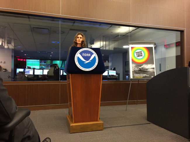
Dr. Kathryn Sullivan, Administrator for the
National Oceanic and Atmospheric Administration (NOAA), federal parent
organization of the National Sea Grant College Program, issued the
analysis.
NOAA’s Climate Prediction Center is forecasting a near-normal or below-normal season. The main driver of this year’s outlook is the anticipated development of El Niño this summer. El Niño causes stronger wind shear, which reduces the number and intensity of tropical storms and hurricanes. El Niño can also strengthen the trade winds and increase the atmospheric stability across the tropical Atlantic, making it more difficult for cloud systems coming off of Africa to intensify into tropical storms.
During NOAA's press conference announcement, there were nearly two dozen TV cameras in the room as well nearly 100 reporters linked in via teleconference. Media outlets included WCBS Radio 880 AM, News 12, NY1,
National Geographic,
USA Today,
The Washington Post,
The New York Times, NBC 4 News, Weather.com/The Weather Channel, WNYC Radio, CBS 2 News, among other TV networks, newspapers, radio stations and magazines.

NOAA's 2014 Atlantic hurricane outlook. Last year, Humberto was the first of only two Atlantic hurricanes. It reached peak intensity, with top winds of 90 mph, in the far eastern Atlantic.
The outlook calls for a 50 percent chance of a below-normal season, a 40 percent chance of a near-normal season, and only a 10 percent chance of an above-normal season. For the six-month hurricane season, which begins June 1, NOAA predicts a 70 percent likelihood of 8 to 13 named storms (winds of 39 mph or higher), of which 3 to 6 could become hurricanes (winds of 74 mph or higher), including 1 to 2 major hurricanes (Category 3, 4 or 5; winds of 111 mph or higher).
These numbers are near or below the seasonal averages of 12 named storms, six hurricanes and three major hurricanes, based on the average from 1981 to 2010. The Atlantic hurricane region includes the North Atlantic Ocean, Caribbean Sea and Gulf of Mexico.
“Thanks to the environmental intelligence from NOAA’s network of earth observations, our scientists and meteorologists can provide life-saving products like our new storm surge threat map and our hurricane forecasts,” said Sullivan. “And even though we expect El Niño to suppress the number of storms this season, it’s important to remember it takes only one land falling storm to cause a disaster.”
Dr. Gerry Bell, lead seasonal hurricane forecaster with NOAA’s Climate Prediction Center, said the Atlantic – which has seen above-normal seasons in 12 of the last 20 years – has been in an era of high activity for hurricanes since 1995. However, this high-activity pattern is expected to be offset in 2014 by the impacts of El Niño, and by cooler Atlantic Ocean temperatures than we’ve seen in recent years.
“Atmospheric and oceanic conditions across the tropical Pacific are already taking on some El Niño characteristics. Also, we are currently seeing strong trade winds and wind shear over the tropical Atlantic, and NOAA’s climate models predict these conditions will persist, in part because of El Niño,” said Bell. “The expectation of near-average Atlantic Ocean temperatures this season, rather than the above-average temperatures seen since 1995, also suggests fewer Atlantic hurricanes.”
Most importantly, Bell says, "We need to be prepared each and every season regardless of the outlook."
New Tools Unveiled for Hurricane Forecasting
NOAA National Ocean Service Director Dr. Holly Bamford.
Photo: Paul C. Focazio, NYSG
Prior to Sullivan's delivery of the outlook, the directors of NOAA's
National Ocean Service (NOS) and
National Weather Service (NWS) –
Dr. Holly Bamford (pictured above) and
Dr. Louis Uccellini (pictured below), respectively – briefed invited guests about new and improved hurricane forecast tools from NOAA's National Hurricane Center. "Storm surge maps are being produced every six hours for the entire Atlantic coast as well as the Gulf of Mexico," says Bamford.
NOAA National Weather Service Director Dr. Louis Uccellini.
Photo: Paul C. Focazio, NYSG
NOAA offers several interactive weather-centric features, including an experimental mapping tool to show communities their storm surge flood threat. The map (pictured below) will be issued for coastal areas when a hurricane or tropical storm watch is first issued, or approximately 48 hours before the anticipated onset of tropical storm force winds. The map will show land areas where
storm surge could occur and how high above ground the water could reach in those areas.
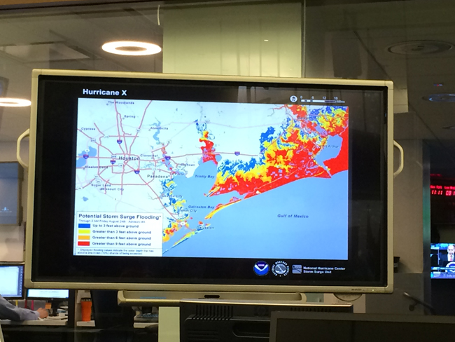
"The visualization tool takes into account the current conditions during a storm – tides and the surge combined," says Bamford.
Photo: Paul C. Focazio, NYSG.
Early testing on continued improvements to NOAA’s
Hurricane Weather Research and Forecasting model (HWRF) shows a 10 percent improvement in this year's model compared to last year. Hurricane forecasters use the HWRF along with other models to produce forecasts and issue warnings. The HWRF model is being adopted by a number of Western Pacific and Indian Ocean rim nations.
On the public-use end, NOAA and the
Federal Emergency Management Agency (FEMA)’s involvement in the innovative
Wireless Emergency Alerts (WEAs) project, a new text-like message system, is part of a national effort to increase emergency preparedness and build a "
Weather-Ready Nation."
"It's important that you have multiple ways to access forecasts and
warnings from NOAA’s National Weather Service before severe weather
strikes,” says Uccellini. "And today's technology makes it easier than
ever to be a good example and share the steps you took to become
weather-ready."
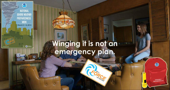
Don't let forecasts of a "below average" season lull you into a false sense of security and not prepare for a hurricane this year. It only takes one land-falling storm to make it a very bad year, and history shows that devastating hurricanes have occurred in below average seasons. With the Atlantic hurricane season having begun on June 1, now is the time to familiarize yourself & your family with hurricane watch/warning terminology, courtesy of
www.hurricanes.gov/prepare:
- A hurricane warning means *one is expected* in your area. Follow evacuation orders from local officials if given
- A hurricane watch means *one is possible* in your area. Know your evacuation route & listen to local officials.
- Don’t put you or your family at risk; follow the instructions of local officials – and if told to evacuate, evacuate.
- To keep up with your local weather forecast, monitor local media updates or visit www.weather.gov.
Last year millions of individuals across the country received WEAs with
life-saving weather warnings via their cell phone. These geographically
targeted emergency alerts have allowed people to receive weather
warnings they would not have otherwise received, and many people took
life-saving action. For more information, visit
www.ready.gov/alerts or see NOAA NWS's
"Weather Warnings On the Go" Q&A. A list of all NOAA-supported social media and mobile Web sites can be found at
www.noaa.gov/socialmedia.
NOAA's "Weather-Ready Nation" Web site features additional resources on
building community resilience in the face of increasing vulnerability to
extreme weather and water events. Included is a section on how you can
"Be a Force of Nature" by knowing your risk related to extreme weather
conditions, taking action and being an example in your community.
There's also NOAA Digital Coast's "
Historical Hurricane Tracks,"
a mapping application that easily searches and displays global tropical
cyclone data. Users are able to query storms by their name and location
(via ZIP Code, city, state, geographic region, or latitude/longitude
coordinates). For storm searches by location, the site lets users insert
their zip code and see a map that contains more than 150 years of
Atlantic hurricane tracking data. It also links to the life histories of
U.S. tropical cyclones since 1958, contains global hurricane data as
far back as 1842, and offers insight on the increasing numbers of U.S.
citizens and infrastructure at risk from big storms.
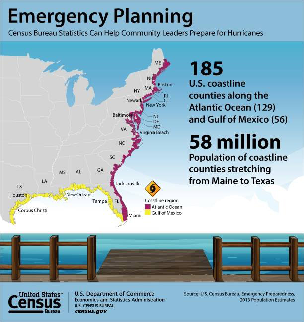
Why it pays to be prepared for Atlantic hurricane season, in one graphic.
Photo: U.S. Census Bureau
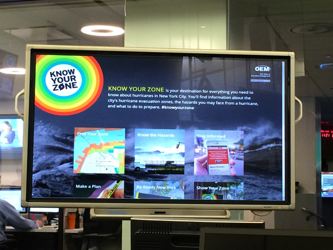
In case an evacuation is required due to severe weather, NOAA and its partners launch a new campaign encouraging everyone in and near coastal communities to "Know Your Zone." The take home message: know your zone (there are six in the New York City area), know that you need to go, when you need to go and go. More info at
www.nyc.gov/knowyourzone.
Photo: Paul C. Focazio, NYSG.
NOAA's Hurricane Outlook: A Forecast of What's to Come?
NOAA’s seasonal hurricane outlook is not a hurricane landfall forecast; it does not predict how many storms will hit land or where a storm will strike. Forecasts for individual storms and their impacts will be provided throughout the season by NOAA’s
National Hurricane Center.
"It only takes one hurricane or tropical storm making landfall to have disastrous impacts on our communities," said
Joe Nimmich, FEMA associate administrator for Response and Recovery. "Just last month, Pensacola, Florida saw five inches of rain in 45 minutes – without a tropical storm or hurricane. We need you to be ready. Know your risk for hurricanes and severe weather, take action now to be prepared and be an example for others in your office, school or community. Learn more about how to prepare for hurricanes at
www.ready.gov/hurricanes."
To help those living in hurricane-prone areas prepare, NOAA offers hurricane preparedness tips, along with video and audio public service announcements in both English and Spanish, featuring NOAA hurricane experts and the FEMA Administrator at
www.hurricanes.gov/prepare.
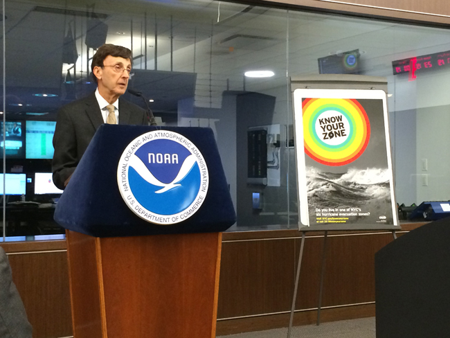
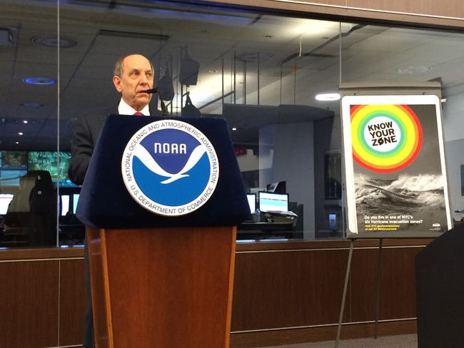
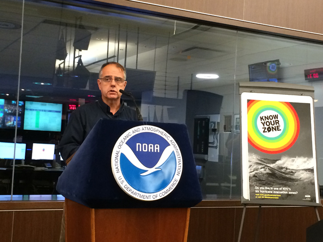
Also at the press conference, NYC OEM Commissioner
Joseph F. Bruno (pictured above) announced a new city-wide hurricane preparedness initiative, and FEMA Associate Administrator for Response and Recovery
Joseph Nimmich (pictured below) offered concluding remarks about hurricane preparedness. "You need to know your threat ... and how to address it," say Nimmich of severe storms. "And when your zone evacuates, you need to know what to take with you. Have a plan in place."
Photos: Paul C. Focazio, NYSG.

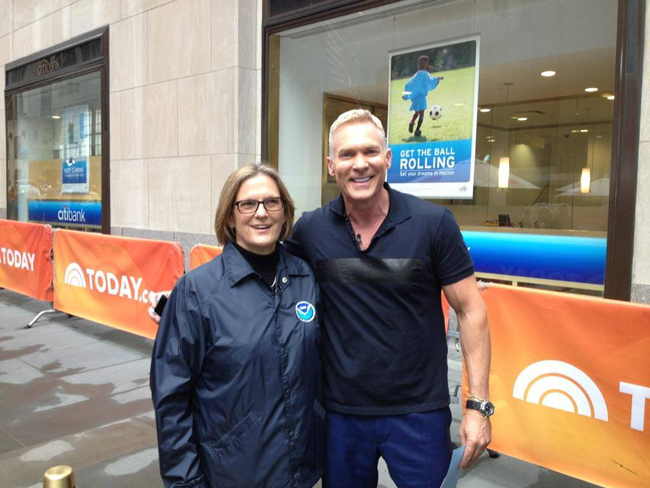
Prior to the mid-morning NOAA press briefing, NOAA Administrator Dr. Kathryn Sullivan promoted the event with weathermen/newscasters
Al Roker (pictured above) and
Sam Champion (pictured below) in New York City. At the conference, Sullivan said, "No number erases the fact that we're starting into hurricane season and that it only takes one destructive storm to impact our coastline and communities."
Photos: Chris Vaccaro, NOAA.
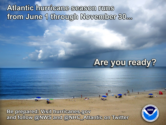
The Atlantic hurricane season officially started June 1st–Be ready NOW because #ItOnlyTakesOne to wreak havoc in your community. See
www.hurricanes.gov,
hurricanes.gov/mobile and
ready.gov/hurricanes for preparedness lists and tips.
Photo: NOAA
Sea Grant Is "Weather-Ready," Too
As mentioned, the National Weather Service’s "Weather-Ready Nation"
initiative was begun to help communities throughout the country better
prepare for and respond to severe weather events. Much of that
preparedness has to do with increasing the speed, accuracy, and
effectiveness of weather monitoring and warning mechanisms on the local
level. And finding the strongest ways to communicate weather messages to
residents is key.
That is why, as part of the Weather-Ready Nation project, the
Great Lakes Social Science Network conducted extensive research into the most effective impact-based warnings. Their report, “
Evaluation of the National Weather Service Impact-based Warning Tool” (
pdf), utilized interviews, focus groups, and surveys to evaluation a new tool for alerting emergency managers and broadcast media about severe weather in order to assist them in more effectively communicating warnings to the public.
“Understanding how to best communicate about severe weather is imperative," says New York Sea Grant Associate Director
Dr. Kathy Bunting-Howarth, a member of the research team. "We hope to take the lessons learned from this project as well as the research results being conducted under the Coastal Storms Awareness Program and assist our NOAA partners and communities be better prepared for the next severe weather event."
National Weather Service piloted an impact-based warning system in 2012 in five select offices, and expanded it to the central region’s 38 offices in 2013. The report offers a sort of mid-term evaluation of the system’s effectiveness and stakeholders’ perceptions of it, while also providing recommendations for further training and implementation improvements.
This research was a team effort between representatives from five Great Lakes Sea Grant programs:
Caitie McCoy and
Leslie Dorworth (Illinois-Indiana Sea Grant),
Dr. Jane Harrison (Wisconsin Sea Grant),
Dr. Kathy Bunting-Howarth (New York Sea Grant),
Hilarie Sorensen (Minnesota Sea Grant),
Katie Williams (University of Wisconsin-Milwaukee), and
Dr. Chris Ellis (NOAA Coastal Services Center). The report was presented earlier this year to the Social Coast Forum in Charleston, SC, sparking a number of other groups and agencies to inquire about the report and possible opportunities to expand on it with further research.
— Compiled by Paul C. Focazio, NYSG's Web Content Manager
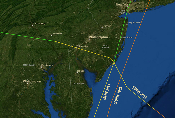
Tracks of superstorm Sandy, Tropical Storm Irene and Hurricane Gloria.
Photo: NOAA
More Info: NOAA
NOAA's mission is to understand and predict changes in the Earth's environment, from the depths of the ocean to the surface of the sun, and to conserve and manage our coastal and marine resources. Join NOAA on
Twitter,
Facebook and our other
social media channels and visit the organization's
news release archive.
More Info: New York Sea Grant
New York Sea Grant (NYSG), a cooperative program of Cornell University
and the State University of New York, is one of 33 university-based
programs under the National Sea Grant College Program (NSGCP) of the
National Oceanic and Atmospheric Administration (NOAA). The NSGCP
engages this network of the nation’s top universities in conducting
scientific research, education, training and extension projects designed
to foster science-based decisions about the use and conservation of our
aquatic resources. Through its statewide network of integrated
services, NYSG has been promoting coastal vitality, environmental
sustainability, and citizen awareness about the State’s marine and Great
Lakes resources since 1971.
For updates on Sea Grant activities:
www.nyseagrant.org has RSS,
Facebook,
Twitter, and
YouTube links. NYSG also offers a free e-list sign up via
www.nyseagrant.org/coastlines for
NY Coastlines, its flagship publication, which, in 2014, merges with the program's e-newsletter,
Currents.
NY Coastlines is published several times a year.