NYSG Brings Coastal Processes Expertise to Meet Shoreline Communities’ Needs
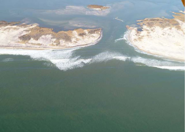
In a year’s time, the north end of the breach in Fire Island has
doubled in width. The south end has opened up to over 750 meters,
November 2013, photo: C. Flagg
New York, NY, April 1, 2014 - As remnants of Sandy slammed into the Long Island coast, breaching Fire Island in three locations, it was immediately apparent that information was needed to assess the damage and potential for further threats to portion of the mainland across Great South Bay containing 13,000 homes collectively valued at $10 billion. With New York Sea Grant support,
Charlie Flagg of Stony Brook University’s School of Marine and Atmospheric Sciences (SoMAS) began aerial observations of the inlet.
The overflight photos and water level data indicated that the breach was not very large and there were no significant tidal changes in the Bay. There has been a large increase in salinity in the eastern portion of the Bay, but this was not judged detrimental to the Bay’s ecology. Rather, according to Flagg, the greater ocean-Bay exchange suggests net improvements to water quality. The breach has migrated westward while slowly rotating clockwise in the expected manner for breaches on this shoreline. The western shoreline has been significantly eroded while deposition along the eastern shore has not kept up.
As a result of Sea Grant’s initial funding the monitoring of the breach continues with a follow-on grant from the National Park Service. NYSG’s support of the early sampling was vital to provide managers with the critical information necessary to make science based decisions regarding the fate of the breach. The investigator and others have given a series of talks about the breach to numerous south shore communities as well as presentations to the South Shore Estuary Reserve, the NYSDEC’s breach advisory panel, the 2013 American Geophysical Union, and another scheduled for the upcoming 2014 Ocean Sciences meeting.
For more, see our in-depth feature "
On Blog, On YouTube: Superstorm Sandy: One Year Later - Long Island Breach," which includes a video discussion with and blog commentary by Flagg. The
blog entry with data from Flagg and fellow SBU SoMAS investigator
Roger Flood is a documentation of the breach's evolution at Old Inlet from shortly after its inception during Superstorm Sandy (late October/early November 2012) through January 2014.