<< Visualizing Coastal Change in Metro NY - Resource Main Page
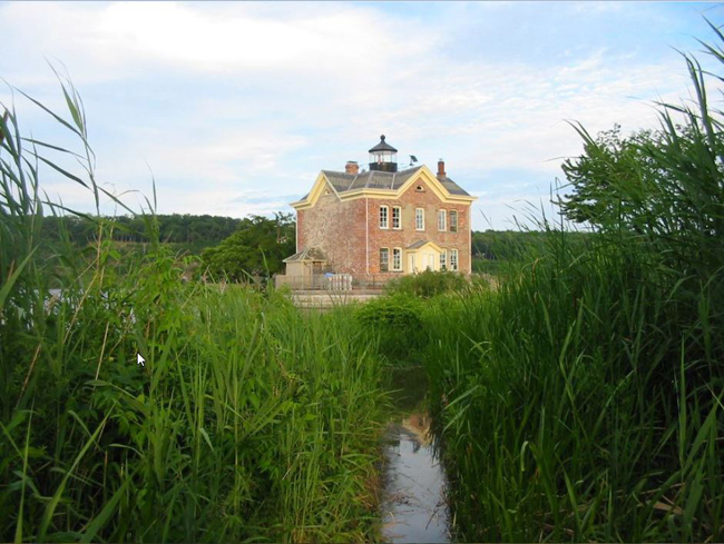
Located along the Hudson River at the mouth of the Esopus Creek, the
land surrounding the trail to the
Saugerties Lighthouse consists of 17 acres of
wooded grounds and tidal wetland flats. The area is supported by a
sandbar comprised of dredged sediments from the channelization projects
of 1888 and 1889, at which point the Esopus Creek was deepened to make
way for ship access to the Saugerties Harbor.
Home to nearly 100 species of flora, the trail’s unique plant life
includes trees, shrubs, vines, herbs, sedges, grasses and ferns. Over
the years, the area has seen an increase in exotic invasive species such
as tall
Phragmites reeds and the Eurasian water chestnut, colloquially known as devil’s heads or cow heads.
(
Source: Saugerties Lighthouse Conservancy)
Study Site Narrative (
pdf)
Study Site Maps
- Nautical Chart (1855) (pdf)
- Historic Topographic Map (1897) (pdf)
- Historic Air Photo Map (1954) (pdf)
- Historic Topographic Map (1897) (pdf)
- Historic DoT Map (1975) (pdf)
- Current Air Photo Map (1994) (pdf)
Workshop Exercises: Files
- Aerial Photographs (pdf)
- Site Characterizations (pdf)
- Topographic Maps (pdf)